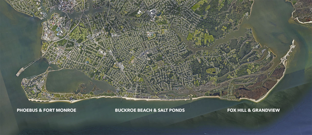
Six neighborhoods in Hampton, which are linked geographically but have different levels of socioeconomic status, different built environments, and different priorities and vulnerabilities.
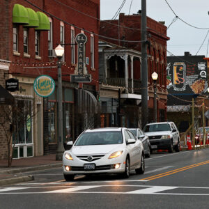
Buffered by Old Point Comfort (the site of Fort Monroe), Phoebus has some defense from major storms. However, both Phoebus and Fort Monroe are experiencing increasingly frequent tidal flooding.
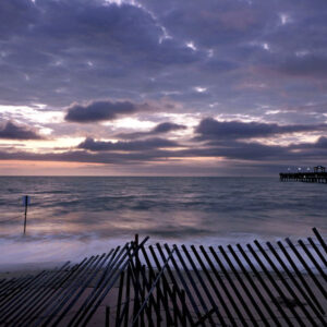
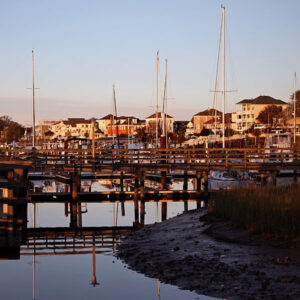
Buckroe Beach is identified as a recreational and tourist asset with a hardened bay-facing edge typology. The area is one of the oldest communities and has historically been a key attraction for Hampton.
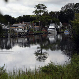
In Fox Hill, as with other low-lying areas in Hampton, marshes protect shorelines from erosion, provide habitat for wildlife, and create nature-rich environments appreciated by the area’s residents.
Now a National Monument, Fort Monroe has a long history as a site for national defense as well as the emancipation of enslaved African Americans during the Civil War. The area is in the process of transitioning from restricted military to a mixed-use neighborhood.
Smart development in places vulnerable to flooding presents complex challenges. Residential areas are being developed between Salt Ponds and the Chesapeake Bay.
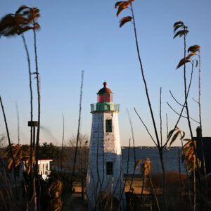
The Grandview Lighthouse stood for 127 years both as a guide to those on the water and as an important gathering place for the community. Although ultimately taken by erosion and a series of storms, it remains a symbol of a strong coastal community.
Fort Monroe national monument (historic significance.)
Historic structures, separate cultural identity from the rest of Hampton.
Flooding in the downtown area.
Higher elevation than the other two locations.
Beach erosion affecting residential lots, need for continual nourishment.
Platted beach-front single family lots allow for new development in high-risk areas.
Tourism
First area in Hampton that will be underwater = opportunities for managed retreat.
Vulnerable infrastructure- flooding of main access road and power substation
Residents are comfortable with some level of flooding.
Culture of living on water, fishing, more rural than most of Hampton.
High water table, strong wave energy, legacy of poor land use and management decisions.
Benefits of this location
Integrate multiple scales, easy to engage multiple disciplines
Specific lot, neighborhoods, and the boundaries beyond the neighborhood. As some residents move, where do they move to, and how do you keep them in the City?
Opportunities for architects/engineers to design a “Hampton House”
What does a new home look like in this region- if we are looking 50 years into the future?
Can science better inform not just management decisions but design and, through design, generate a desire for something new – a better place?
Identify an archetype for coastal architecture, that acknowledges the history and culture of Hampton while ensuring safer and more equitable homeownership, while still allowing residents to live with water.
Options for...
Landscape Architects
Explore the feasibility of “living breakwaters.”
Consider areas for managed retreat, and explore how ecological services/green infrastructure can be implemented or expanded in the areas that are destined to go underwater.
Social Sciences/Economists
Explore social equity and environmental justice issues- where is money invested in the community?
Who receives the funding necessary to stay in place?
What is the total ownership cost of keeping people in place versus moving them?